


Luca Brocca
Just Access Representative to the UNCAC
When thinking about military space technologies, we typically associate them with surveillance and battlefield intelligence.┬Ā Yet, these advanced technologies have significant potential to address one of humanityŌĆÖs greatest challenges: climate change.
The same space technology that is being used for national security matters can provide environmental data to help governments combat global warming.┬Ā This is because many of these technologies are dual-use, meaning they serve both military and civilian purposes.┬Ā For instance, data collection from military satellites operating in the long-term can help predict climate trends and anticipate natural disasters.┬Ā This blog post will give an overview of how military space technologies can be leveraged to combat climate change.
The same space technology being used for national security matters can provide environmental data that helps governments combat global warming.
Eyes in the Sky: A Powerful Climate Monitoring Tool
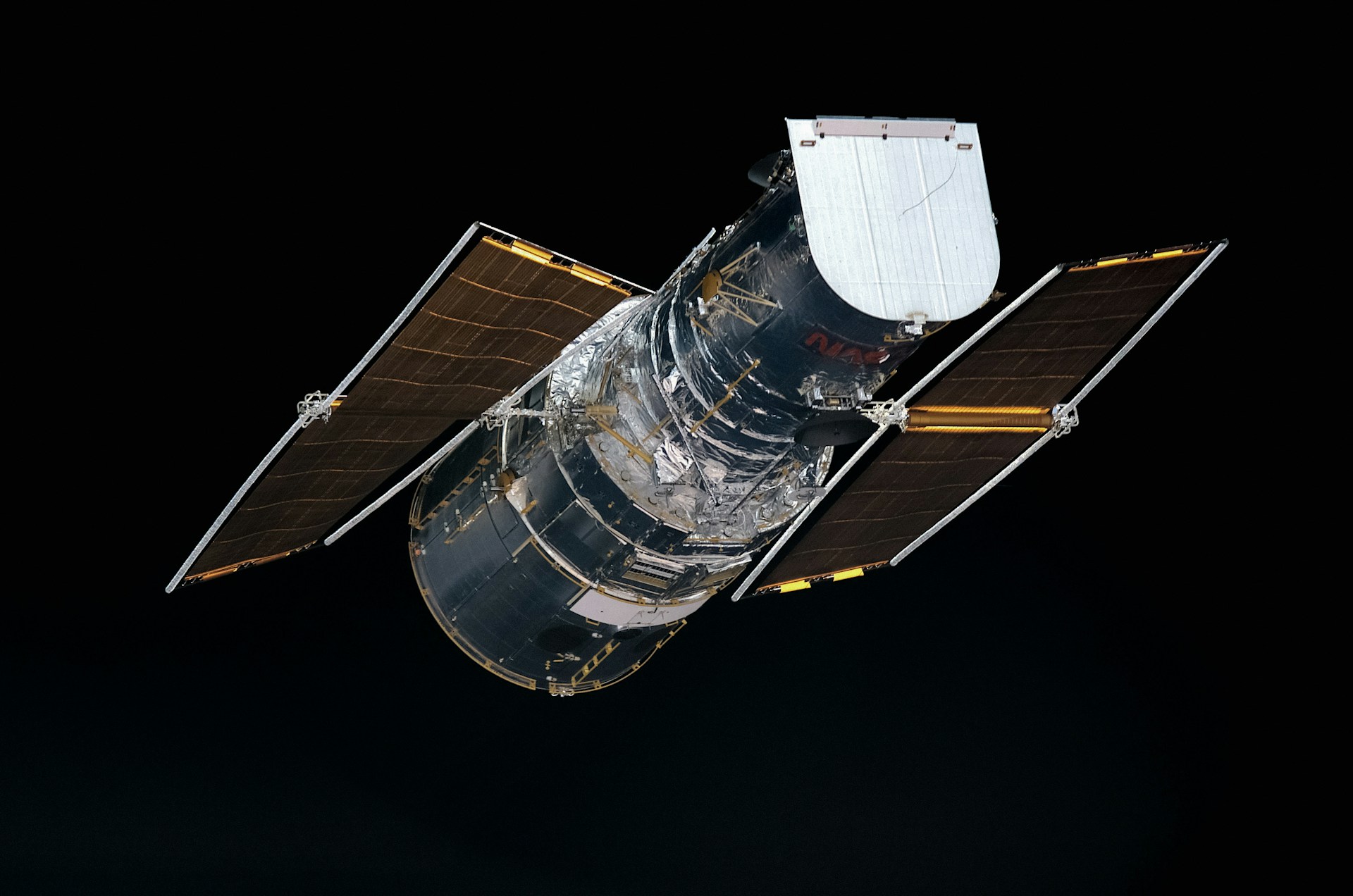
Military satellites are designed for precision.┬Ā Therefore, high-resolution imaging and infrared sensors can detect environmental changes in real time.┬Ā These satellites can track deforestation and rising sea levels with a level of detail often unmatched by civilian satellites.┬Ā Given their strategic importance, military satellites also tend to have greater funding and innovative technology that can be leveraged for climate monitoring.
For example, the USA-282 (SBIRS), a military satellite originally designed to detect missile launches through infrared imaging, could be repurposed to also track wildfires and volcanic activity by detecting heat in specific areas.┬Ā Thanks to its ability to quickly detect environmental threats, this military satellite can enable faster intervention and more effective environmental adaptation tactics than what is otherwise offered by civilian-use satellites.┬Ā In fact, many civilian Earth observation satellites, like Copernicus, have data refresh times of several days, which is different from military satellites which are normally designed for immediate responses to threats.
Similarly, KH-11 Kennen, an American spy satellite with extremely high-resolution optical imaging, originally developed for ┬Ā, could help track illegal logging or desertification, and provide data on the agricultural changes caused by shifting climate patterns.
Support our work!
We can only do our work thanks to the support of brave, passionate people like you!
Your donation will help us to keep fighting for human rights and access to justice for everyone, everywhere.
SAR for Disaster Response and Prevention
Synthetic Aperture Radar (SAR) is a remote sensing technology that enables detailed imaging of the Earth’s surface, regardless of the weather conditions or time of day.┬Ā Since it uses radar waves instead of visible light, SAR can penetrate cloud cover, darkness, and even some vegetation, which makes it a great tool for monitoring environmental changes and responding to natural disasters.
The Lacrosse/Onyx reconnaissance satellites exemplify the usefulness of this data collection instrument. Thanks to their SAR technology, these satellites can even see through clouds and during nighttime, a capacity that could be used to monitor natural disasters and map floods even in extreme weather conditions.
Defence satellites originally built to detect missile launches could be repurposed to track wildfires and volcanic activity.
Satellites to Bridge the Data Gap
One of the biggest obstacles in the fight against climate change is the lack of comprehensive, high-quality data.┬Ā Many regions, especially in the developing world, lack the infrastructure for climate monitoring.┬Ā Military satellites can bridge this gap by providing global coverage and gathering information in areas where civilian satellites may have limited access.
For example, the previously mentioned KH-11 Kennen is capable of capturing ultra-detailed images that could help detect illegal mining or coral reef degradation in remote areas, particularly if it incorporates dedicated environmental sensors.┬Ā With military and private-sector collaboration, these data can be shared with policymakers and international organisations working in the field of climate adaptation.
Challenges and the Path Forward
Despite their potential, repurposing military satellites for climate action is not without challenges.┬Ā Defence agencies prioritise national security, so environmental monitoring is often seen as a secondary mission.┬Ā Additionally, the classified nature of some military satellite operations makes it difficult to share data openly.
However, increased recognition of climate change as a security threat could push governments to integrate climate monitoring into military satellite operations.┬Ā PublicŌĆōprivate partnerships between defence contractors and environmental organisations are particularly important to facilitate the sharing of relevant data while addressing security concerns.
Fully exploiting the capabilities of military satellites can improve disaster response and environmental protection, using some of the most sophisticated technology available today.
Further Discussion
Space technologies often serve dual purposes.┬Ā Clear examples of this are the European UnionŌĆÖs Copernicus, ┬Ā, and ┬Ā programs, which were initially developed predominantly for civilian use but have also played a role in military operations, such as during the ongoing conflict in Ukraine.
This blog post flips that common trajectory. While civilian technologies are often adapted for military objectives, the reverse should also be true: when governments and private companies invest in satellites primarily for defence purposes, they should also ensure these technologies benefit civilian society. If we fully exploit the capabilities of military satellites, we can improve disaster response and environmental protection with some of the most sophisticated technology available today
This blog post is inspired by the 17th meeting of the Brussels Dialogue on Climate Diplomacy (BDCD) on March 28, 2025, titled ŌĆ£New Frontiers and Tools in Climate Change Adaptation and the Role of Civil-Military Cooperation,ŌĆØ in which Just Access representative Luca Brocca participated. The ConferenceŌĆÖs description can be found at this link
Just Access e.V. is a non-party political organisation, whose mission is to support human rights and access to justice worldwide. ┬ĀThe views and opinions expressed in this piece and those of the author, and do not necessarily represent those of Just Access e.V.┬Ā
Subscribe to the Just Access newsletter
Don’t miss any of our blog posts, or any of our other great content!
Stay up to date with our work by subscribing to the Just Access Newsletter (six mailings per year).